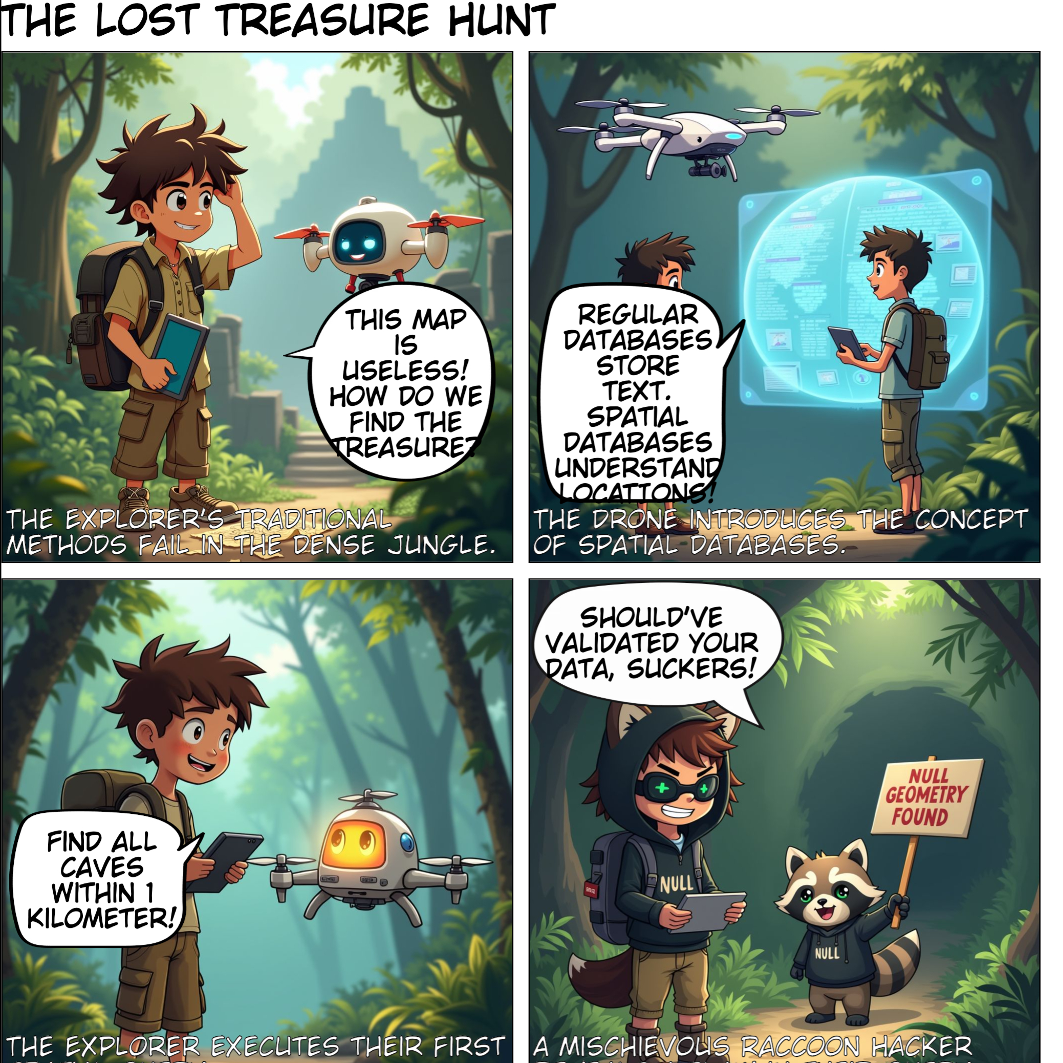
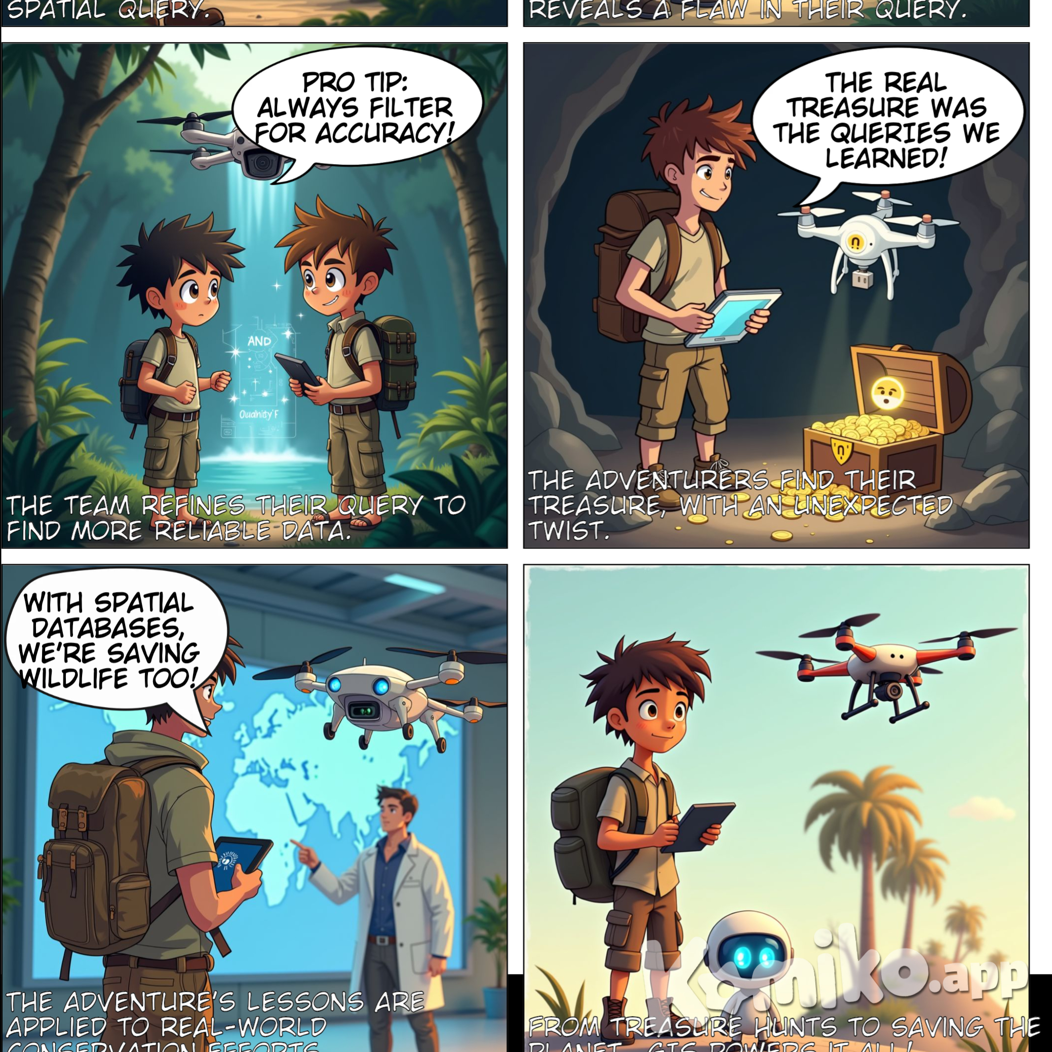
AI Комикс: Title: "The Lost Treasure Hunt: A Spatial Database Adventure" Style: Semi-realistic cartoon (balanced detail + expressiveness) Panel 1: The Lost Explorer Visual Prompt: "A young adventurer (backpack, compass, crumpled paper map) stands in a dense jungle, scratching their head. A high-tech drone with a glowing screen hovers beside them. Vines and ancient ruins in the background." Dialogue: Explorer: "This map is useless! How do we find the treasure now?" Drone: "Paper maps are so 1800s. Let’s ask a SPATIAL DATABASE!" Panel 2: Spatial Database Explained Visual Prompt: "The drone projects a holographic split-screen: Left side shows a boring spreadsheet (rows of numbers). Right side shows an interactive 3D globe with pins, routes, and heatmaps." Dialogue: Drone: "Regular databases store text. Spatial databases understand LOCATIONS—like maps, roads, even volcanoes!" Explorer: "Whoa! So it’s Google Maps on steroids?" Panel 3: The First Query Visual Prompt: "Explorer types on a tablet: ‘SELECT * FROM jungle WHERE feature = ‘cave’ AND distance < 1km’. The drone processes it, and the holographic map highlights a glowing cave icon." Dialogue: Explorer: "Find all caves within 1 kilometer!" Drone: "Executing spatial query... Bingo!" Panel 4: The Villain Strikes Visual Prompt: "They reach a tiny, empty cave. A raccoon in a hacker hoodie giggles, holding a sign: ‘NULL GEOMETRY FOUND’. The drone’s screen shows a red ‘ERROR’ pop-up." Dialogue: Raccoon: "Should’ve validated your data, suckers!" Explorer: "Ugh! Corrupted coordinates!" Panel 5: Debugging the Query Visual Prompt: "The drone and explorer huddle over the tablet, adding ‘AND data_quality = ‘high’’. The map flickers, then reveals a hidden path behind a waterfall (sparkle effects)." Dialogue: Drone: "Pro tip: Always filter for accuracy!" Explorer: "Spatial JOINs for the win!" Panel 6: Treasure Revealed Visual Prompt: "A chest overflows with gold coins and a glowing USB labeled ‘World’s Best GIS Data’. The explorer holds it triumphantly; the drone facepalms." Dialogue: Explorer: "The real treasure was the QUERIES we learned!" Drone: "I hate puns." Panel 7 (Epilogue): Real-World Impact Visual Prompt: "Explorer now wears a lab coat, pointing at a giant screen showing endangered animal tracks on a global map. The drone floats nearby, upgraded with satellite dishes." Dialogue: Explorer: "With spatial databases, we’re saving wildlife too!" Caption: "From treasure hunts to saving the planet—GIS powers it all!"
Создано bouncy unicorn
Подробности содержания
Информация о медиа
Взаимодействие с пользователями
Об этом искусстве
Описание
Сигнал для создания
Вовлечённость

bouncy unicorn

bouncy unicorn
Title: "The Lost Treasure Hunt: A Spatial Database Adventure" Style: Semi-realistic cartoon (balanced detail + expressiveness) Panel 1: The Lost Explorer Visual Prompt: "A young adventurer (backpack, compass, crumpled paper map) stands in a dense jungle, scratching their head. A high-tech drone with a glowing screen hovers beside them. Vines and ancient ruins in the background." Dialogue: Explorer: "This map is useless! How do we find the treasure now?" Drone: "Paper maps are so 1800s. Let’s ask a SPATIAL DATABASE!" Panel 2: Spatial Database Explained Visual Prompt: "The drone projects a holographic split-screen: Left side shows a boring spreadsheet (rows of numbers). Right side shows an interactive 3D globe with pins, routes, and heatmaps." Dialogue: Drone: "Regular databases store text. Spatial databases understand LOCATIONS—like maps, roads, even volcanoes!" Explorer: "Whoa! So it’s Google Maps on steroids?" Panel 3: The First Query Visual Prompt: "Explorer types on a tablet: ‘SELECT * FROM jungle WHERE feature = ‘cave’ AND distance < 1km’. The drone processes it, and the holographic map highlights a glowing cave icon." Dialogue: Explorer: "Find all caves within 1 kilometer!" Drone: "Executing spatial query... Bingo!" Panel 4: The Villain Strikes Visual Prompt: "They reach a tiny, empty cave. A raccoon in a hacker hoodie giggles, holding a sign: ‘NULL GEOMETRY FOUND’. The drone’s screen shows a red ‘ERROR’ pop-up." Dialogue: Raccoon: "Should’ve validated your data, suckers!" Explorer: "Ugh! Corrupted coordinates!" Panel 5: Debugging the Query Visual Prompt: "The drone and explorer huddle over the tablet, adding ‘AND data_quality = ‘high’’. The map flickers, then reveals a hidden path behind a waterfall (sparkle effects)." Dialogue: Drone: "Pro tip: Always filter for accuracy!" Explorer: "Spatial JOINs for the win!" Panel 6: Treasure Revealed Visual Prompt: "A chest overflows with gold coins and a glowing USB labeled ‘World’s Best GIS Data’. The explorer holds it triumphantly; the drone facepalms." Dialogue: Explorer: "The real treasure was the QUERIES we learned!" Drone: "I hate puns." Panel 7 (Epilogue): Real-World Impact Visual Prompt: "Explorer now wears a lab coat, pointing at a giant screen showing endangered animal tracks on a global map. The drone floats nearby, upgraded with satellite dishes." Dialogue: Explorer: "With spatial databases, we’re saving wildlife too!" Caption: "From treasure hunts to saving the planet—GIS powers it all!"
11 months ago